 vesseltracker.com
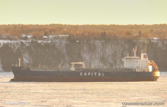
 Atrotos
Current Status
Where is the vessel?
Atrotos is currently in 395 nm SW of Shitan, based on AIS data received about 1h ago.
Latest AIS update:
Current position: 18.94784° N, 119.13209° W (395 nm SW of Shitan)
Average speed (last 7 days): Loading…
Average speed (last 30 days): Loading…
Vessel profile: Atrotos is a Chemical Oil Products Tanker with dimensions 184m x 32m.
This page combines live AIS, route history, probable destination signals, nearby traffic, and port activity for practical vessel monitoring.
The current position of vessel Atrotos is 18.94784 lat / -119.13209 lng. Updated: 2026-05-17 19:58:31 UTCNearest reference points:
- Open sea, approx. 402 nm off the nearest listed port
- Open sea, approx. 405 nm off the nearest listed port
- Open sea, approx. 409 nm off the nearest listed port
Currently sailing under the flag of Liberia ![]()
Atrotos built in 2007 year
Deadweight:
47787 tDetails:
Live Vessel Atrotos Analytics (details, animations, etc.)
Recent AIS points (UTC):
2026-05-17 16:24:48 UTC · 18.22667, -118.87667 · SOG 12 kn · COG -1°2026-05-17 18:11:02 UTC · 18.58846, -119.00057 · SOG 12.6 kn · COG 341°
2026-05-17 19:54:42 UTC · 18.93533, -119.12697 · SOG 12.7 kn · COG 338°
2026-05-17 19:58:31 UTC · 18.94784, -119.13209 · SOG 12.7 kn · COG 338°