 vesseltracker.com
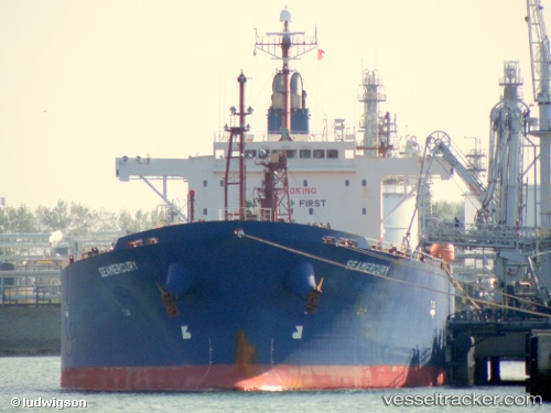
 HARDRADA
Current Status
Where is the vessel?
HARDRADA is currently in Near EL DEKHEILA, based on AIS data received about 1h ago.
Latest AIS update:
Current position: 31.24322° N, 29.74154° E (Near EL DEKHEILA)
Average speed (last 7 days): Loading…
Average speed (last 30 days): Loading…
Vessel profile: HARDRADA is a Oil Products Tanker with dimensions 180m x 32m.
This page combines live AIS, route history, probable destination signals, nearby traffic, and port activity for practical vessel monitoring.
The current position of vessel HARDRADA is 31.24322 lat / 29.74154 lng. Updated: 2026-05-18 02:18:26 UTCNearest reference points:
- Near EL DEKHEILA
- Near Alexandria
- 13 nm W of EL DEKHEILA
Currently sailing under the flag of Liberia ![]()
HARDRADA built in 2007 year
Deadweight:
45983 tDetails:
Live Vessel HARDRADA Analytics (details, animations, etc.)
Recent AIS points (UTC):
2026-05-17 23:03:26 UTC · 31.24196, 29.74079 · SOG 0.1 kn · COG 74°2026-05-17 23:39:27 UTC · 31.24264, 29.74082 · SOG 0.1 kn · COG 108°
2026-05-18 02:06:26 UTC · 31.24320, 29.74171 · SOG 0.1 kn · COG 104°
2026-05-18 02:18:26 UTC · 31.24322, 29.74154 · SOG 0.1 kn · COG 102°