 vesseltracker.com
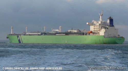
 NY LORD
Current Status
Where is the vessel?
NY LORD is currently in Near MARIVELES, based on AIS data received less than 1h ago.
Latest AIS update:
Current position: 14.37017° N, 120.44313° E (Near MARIVELES)
Average speed (last 7 days): Loading…
Average speed (last 30 days): Loading…
Vessel profile: NY LORD is a Lpg Tanker with dimensions m x m.
This page combines live AIS, route history, probable destination signals, nearby traffic, and port activity for practical vessel monitoring.
The current position of vessel NY LORD is 14.37017 lat / 120.44313 lng. Updated: 2026-05-18 07:45:21 UTCNearest reference points:
- 19 nm SW of MARIVELES
- Near Nasugbu, Luzon
- Near Noveleta
Currently sailing under the flag of Liberia ![]()
Details:
Live Vessel NY LORD Analytics (details, animations, etc.)
Recent AIS points (UTC):
2026-05-18 04:25:37 UTC · 14.42555, 120.57173 · SOG 0 kn · COG 249°2026-05-18 05:43:37 UTC · 14.42557, 120.57171 · SOG 0 kn · COG 249°
2026-05-18 07:27:52 UTC · 14.38352, 120.50237 · SOG 11.3 kn · COG 250°
2026-05-18 07:45:21 UTC · 14.37017, 120.44313 · SOG 12.9 kn · COG 255°