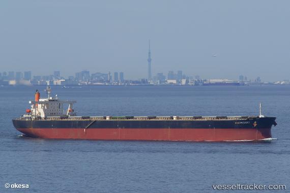
.
Vessel photo of Kachidoki (IMO 9355147) vesseltracker.com

PA flag Kachidoki

Vessel type: Ore Carrier | IMO: 9355147 | MMSI: MMSI: 355765000
Call sign: 3EFH | Dimensions: 300 m x 50 m
Current Status

Where is the vessel?

Kachidoki is currently in 182 nm SW of Panjang, based on AIS data received less than 1h ago.

Latest AIS update:

Current position: 7.93332° S, 102.64541° E (182 nm SW of Panjang)

Average speed (last 7 days): Loading…

Average speed (last 30 days): Loading…

Vessel profile: Kachidoki is a Ore Carrier with dimensions 300m x 50m.

This page combines live AIS, route history, probable destination signals, nearby traffic, and port activity for practical vessel monitoring.

The current position of vessel Kachidoki is -7.93332 lat / 102.64541 lng. Updated: 2026-05-18 02:48:19 UTC
Nearest reference points:
  • 163 nm W of Panjang
  • 28 nm SW of Tarahan
  • 29 nm SW of Tarahan

Currently sailing under the flag of Panama PA flag

Kachidoki built in 2006 year

Deadweight:
206291 t

Details:

Live Vessel Kachidoki Analytics (details, animations, etc.)


Recent AIS points (UTC):
2026-05-17 23:58:01 UTC · -8.18481, 102.22960 · SOG 10.2 kn · COG 57°
2026-05-18 00:54:47 UTC · -8.10522, 102.37106 · SOG 10.1 kn · COG 67°
2026-05-18 02:48:19 UTC · -7.93332, 102.64541 · SOG 10.4 kn · COG 67°

UTC: --
Start: -- Track timeline (UTC) End: --
Encountered: --


Link to the map:


Find another ship

Kachidoki (355765000) last ports (portcalls and passsages)

TANAH MERAH | 2025-09-01 10:27:34
PENGERANG | 2025-09-01 09:49:14
JINGTANG | 2025-08-22 12:24:22
JINGTANG | 2025-08-18 10:58:57
SURALAYA | 2025-08-06 19:03:48
MERAK | 2025-08-06 18:18:59
Selat Sunda | 2025-08-06 17:02:11
PULAU SAMBU | 2025-05-30 09:31:29
BATU AMPAR | 2025-05-30 08:57:50
TANAH MERAH | 2025-05-29 15:18:43
PENGERANG | 2025-05-29 13:12:31
Taicang | 2025-05-19 10:11:44
Wusong | 2025-05-19 07:50:34
Jingjiang | 2025-05-19 03:22:25
ZHOUSHAN | 2025-05-15 03:06:35
SURALAYA | 2025-05-04 21:22:14
MERAK | 2025-05-04 20:00:01
Selat Sunda | 2025-05-04 18:50:18
BUKOM ISLAND | 2025-02-14 12:26:05
TANAH MERAH | 2025-02-13 17:16:32
PENGERANG | 2025-02-13 16:23:18
HUANGHUA | 2025-02-01 09:00:32
SURALAYA | 2025-01-18 11:01:48
Selat Sunda | 2025-01-18 09:50:01
Singapore | 2024-11-01 16:14:34
Jingjiang | 2024-10-24 06:56:40
Wusong | 2024-10-24 01:52:51
Zhangjiagang | 2024-10-21 05:52:51
Nantong | 2024-10-21 03:19:14
Taicang | 2024-10-20 23:59:25
Wusong | 2024-10-19 05:17:11
Jingjiang | 2024-10-19 00:25:49
Singapore | 2024-10-07 00:08:42
Sambu | 2024-07-30 01:32:39
Singapore | 2024-07-29 07:10:30
Selat Lombok | 2024-07-03 22:47:27
Port Headland | 2024-06-29 14:07:12
Selat Lombok | 2024-06-23 19:23:57
Selat Lombok | 2024-05-28 18:56:42
Port Headland | 2024-05-24 21:20:59
Selat Lombok | 2024-05-20 05:36:47
Selat Lombok | 2024-04-26 18:23:20
Port Headland | 2024-04-22 08:50:43
Selat Lombok | 2024-04-12 10:35:16
Selat Lombok | 2024-02-26 04:42:40
Port Headland | 2024-02-21 12:03:21
Selat Lombok | 2024-02-11 18:20:10
Fangcheng | 2024-02-03 05:14:09
Fangcheng | 2024-01-30 04:25:45
Singapore | 2024-01-22 11:11:28
Saldanha Bay | 2023-12-23 21:32:51
Sambu | 2023-12-04 12:41:57
Singapore | 2023-12-03 01:04:42
Singapore | 2023-07-01 20:33:28
Sambu | 2023-07-01 17:44:57
Selat Lombok | 2023-06-16 05:07:07
Port Headland | 2023-06-12 12:18:58
Selat Lombok | 2023-05-08 07:30:26
Port Headland | 2023-05-04 00:23:59
Selat Lombok | 2023-04-18 03:44:56
Dagu Bar | 2023-04-02 07:18:57
Port Headland | 2023-03-15 17:18:47
Wusong | 2023-02-27 10:46:48
Selat Lombok | 2023-01-30 11:29:27
Port Headland | 2023-01-26 08:42:44
Selat Sunda | 2022-12-16 08:37:49
Sambu | 2022-08-03 16:59:00
Richards Bay | 2022-07-15 07:45:19
Richards Bay | 2022-07-08 20:00:04
Singapore | 2022-05-24 01:30:17
Wusong | 2022-03-09 15:11:06
Lianyungang | 2022-02-23 03:07:01
Port Headland | 2022-01-26 14:05:23
Lianyungang | 2022-01-06 09:29:33