 vesseltracker.com
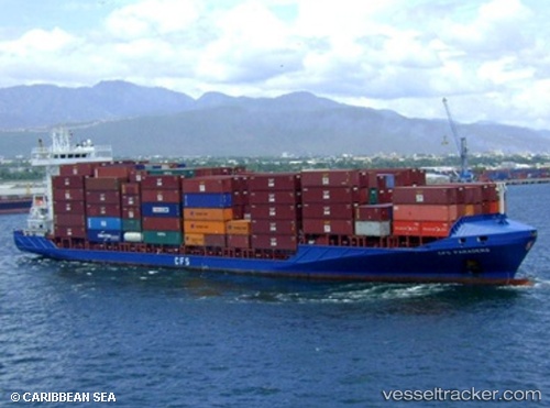
 PARADERO
Current Status
Where is the vessel?
PARADERO is currently in 51 nm SW of Barahona, based on AIS data received less than 1h ago.
Latest AIS update:
Current position: 17.51167° N, 71.56333° W (51 nm SW of Barahona)
Average speed (last 7 days): Loading…
Average speed (last 30 days): Loading…
Vessel profile: PARADERO is a Container Ship with dimensions 140m x 22m.
This page combines live AIS, route history, probable destination signals, nearby traffic, and port activity for practical vessel monitoring.
The current position of vessel PARADERO is 17.51167 lat / -71.56333 lng. Updated: 2026-05-17 23:30:04 UTCNearest reference points:
- Near Bahia De Las Calderas
- Near Puerto Plata
Currently sailing under the flag of Antigua and Barbuda ![]()
PARADERO built in 2007 year
Deadweight:
11193 tDetails:
Live Vessel PARADERO Analytics (details, animations, etc.)
Recent AIS points (UTC):
2026-05-17 20:11:00 UTC · 17.82521, -70.88377 · SOG 12.8 kn · COG 240°2026-05-17 22:07:47 UTC · 17.62709, -71.27630 · SOG 13.1 kn · COG 239°
2026-05-17 22:21:02 UTC · 17.60333, -71.32000 · SOG 13 kn · COG -1°
2026-05-17 23:30:04 UTC · 17.51167, -71.56333 · SOG 13 kn · COG -1°