 vesseltracker.com
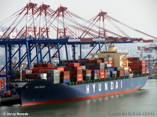
 HYUNDAI OAKLAND
Current Status
Where is the vessel?
HYUNDAI OAKLAND is currently in 143 nm SE of Porto Santo Island, based on AIS data received less than 1h ago.
Latest AIS update:
Current position: 31.64898° N, 14.07492° W (143 nm SE of Porto Santo Island)
Average speed (last 7 days): Loading…
Average speed (last 30 days): Loading…
Vessel profile: HYUNDAI OAKLAND is a Container Ship with dimensions 40m x 293m.
This page combines live AIS, route history, probable destination signals, nearby traffic, and port activity for practical vessel monitoring.
The current position of vessel HYUNDAI OAKLAND is 31.64898 lat / -14.07492 lng. Updated: 2026-05-18 08:16:04 UTCNearest reference points:
- 148 nm SE of Porto Santo Island
- 109 nm E of Porto Santo Island
- 83 nm N of Caleta de Sebo
Currently sailing under the flag of Korea (Republic of) ![]()
HYUNDAI OAKLAND built in 2009 year
Deadweight:
72982 tDetails:
Live Vessel HYUNDAI OAKLAND Analytics (details, animations, etc.)
Recent AIS points (UTC):
2026-05-18 04:48:44 UTC · 32.54403, -13.84678 · SOG 16 kn · COG 195°2026-05-18 05:47:43 UTC · 32.28477, -13.91083 · SOG 15.9 kn · COG 189°
2026-05-18 07:00:52 UTC · 31.96973, -13.98893 · SOG 15.6 kn · COG 191°
2026-05-18 08:16:04 UTC · 31.64898, -14.07492 · SOG 15.6 kn · COG 189°