 vesseltracker.com
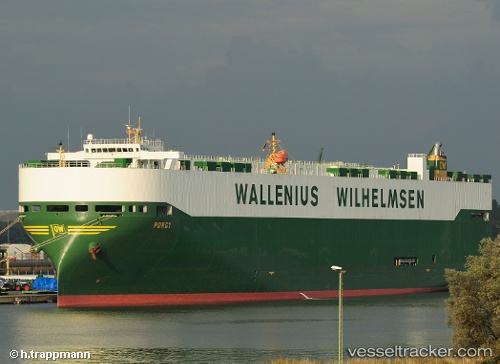
 PORGY
PORGY
Current Status
Where is the vessel?
PORGY is currently in Near Port Hueneme, based on AIS data received about 1h ago.
Latest AIS update:
Current position: 34.11669° N, 119.20664° W (Near Port Hueneme)
Average speed (last 7 days): Loading…
Average speed (last 30 days): Loading…
Vessel profile: PORGY is a Vehicles Carrier with dimensions m x m.
This page combines live AIS, route history, probable destination signals, nearby traffic, and port activity for practical vessel monitoring.
The current position of vessel PORGY is 34.11669 lat / -119.20664 lng. Updated: 2026-05-18 06:23:55 UTCNearest reference points:
- Near Hueneme
- Near CHANNEL ISLANDS
- Near VENTURA
Currently sailing under the flag of Norway ![]()
Details:
Live Vessel PORGY Analytics (details, animations, etc.)
Recent AIS points (UTC):
2026-05-18 01:54:02 UTC · 34.11674, -119.20658 · SOG 0.4 kn · COG 278°2026-05-18 03:32:55 UTC · 34.11683, -119.20654 · SOG 0 kn · COG 246°
2026-05-18 04:18:01 UTC · 34.11679, -119.20657 · SOG 0.1 kn · COG 252°
2026-05-18 06:23:55 UTC · 34.11669, -119.20664 · SOG 0 kn · COG 257°