 vesseltracker.com
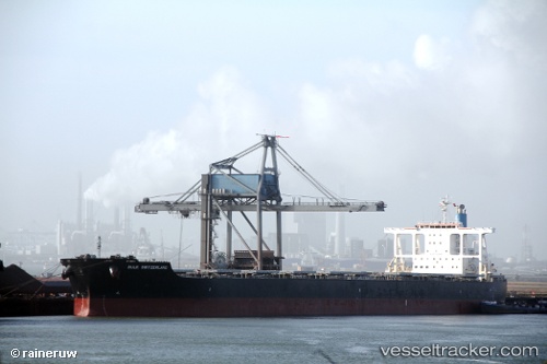
 PATRIOTSHIP
Current Status
Where is the vessel?
PATRIOTSHIP is currently in 335 nm NE of Levelwood, based on AIS data received about 1h ago.
Latest AIS update:
Current position: 11.89062° S, 1.01470° W (335 nm NE of Levelwood)
Average speed (last 7 days): Loading…
Average speed (last 30 days): Loading…
Vessel profile: PATRIOTSHIP is a Bulk Carrier with dimensions 45m x 289m.
This page combines live AIS, route history, probable destination signals, nearby traffic, and port activity for practical vessel monitoring.
The current position of vessel PATRIOTSHIP is -11.89062 lat / -1.01470 lng. Updated: 2026-05-17 19:47:56 UTCNearest reference points:
- Open sea, approx. 402 nm off the nearest listed port
- Open sea, approx. 400 nm off the nearest listed port
- Open sea, approx. 404 nm off the nearest listed port
Currently sailing under the flag of Marshall Islands ![]()
PATRIOTSHIP built in 2010 year
Deadweight:
181709 tDetails:
Live Vessel PATRIOTSHIP Analytics (details, animations, etc.)
Recent AIS points (UTC):
2026-05-17 16:20:12 UTC · -11.38746, -1.41142 · SOG 10.9 kn · COG 141°2026-05-17 17:37:54 UTC · -11.57410, -1.26469 · SOG 11 kn · COG 144°
2026-05-17 19:38:55 UTC · -11.86864, -1.03180 · SOG 11 kn · COG 142°
2026-05-17 19:47:56 UTC · -11.89062, -1.01470 · SOG 11 kn · COG 143°