 vesseltracker.com
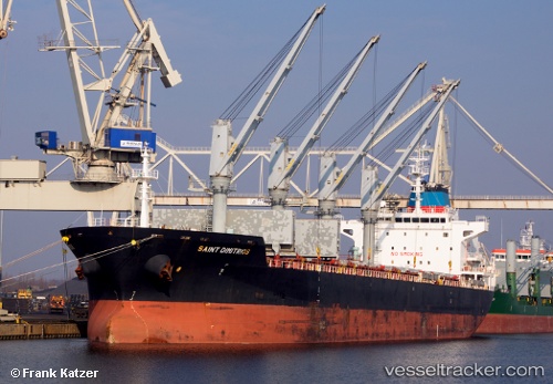
 SAINT DIMITRIOS
Current Status
Where is the vessel?
SAINT DIMITRIOS is currently in 155 nm W of Billingborough, based on AIS data received less than 1h ago.
Latest AIS update:
Current position: 53.70667° N, 24.10833° W (155 nm W of Billingborough)
Average speed (last 7 days): Loading…
Average speed (last 30 days): Loading…
Vessel profile: SAINT DIMITRIOS is a Bulk Carrier with dimensions m x m.
This page combines live AIS, route history, probable destination signals, nearby traffic, and port activity for practical vessel monitoring.
The current position of vessel SAINT DIMITRIOS is 53.70667 lat / -24.10833 lng. Updated: 2026-05-18 03:51:30 UTCNearest reference points:
- 162 nm NW of Billingborough
Currently sailing under the flag of Portugal ![]()
Details:
Live Vessel SAINT DIMITRIOS Analytics (details, animations, etc.)
Recent AIS points (UTC):
2026-05-18 00:02:46 UTC · 53.36180, -25.03017 · SOG 10.6 kn · COG 58°2026-05-18 01:09:28 UTC · 53.46333, -24.75333 · SOG 10 kn · COG -1°
2026-05-18 02:00:27 UTC · 53.54167, -24.54833 · SOG 10 kn · COG -1°
2026-05-18 03:51:30 UTC · 53.70667, -24.10833 · SOG 9 kn · COG -1°