 vesseltracker.com
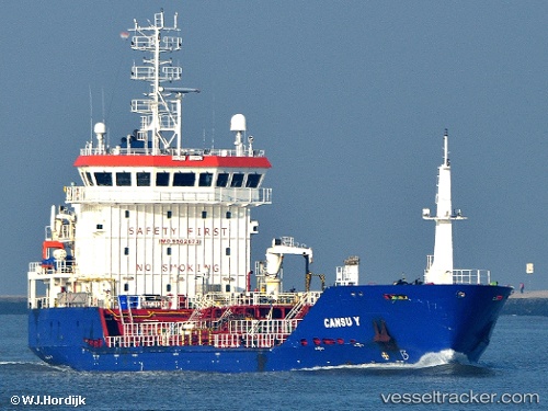
 CANSU Y
Current Status
Where is the vessel?
CANSU Y is currently in 51 nm SW of Ile D’Ouessant, based on AIS data received about 2h ago.
Latest AIS update:
Current position: 47.94288° N, 6.17728° W (51 nm SW of Ile D’Ouessant)
Average speed (last 7 days): Loading…
Average speed (last 30 days): Loading…
Vessel profile: CANSU Y is a Oil/Chemical Tanker with dimensions m x m.
This page combines live AIS, route history, probable destination signals, nearby traffic, and port activity for practical vessel monitoring.
The current position of vessel CANSU Y is 47.94288 lat / -6.17728 lng. Updated: 2026-05-17 17:40:53 UTCNearest reference points:
- 46 nm W of SEIN
- 35 nm SW of Ile D’Ouessant
- 60 nm SE of San Clodio
Currently sailing under the flag of Barbados ![]()
Details:
Live Vessel CANSU Y Analytics (details, animations, etc.)
Recent AIS points (UTC):
2026-05-17 16:05:46 UTC · 48.21751, -6.37718 · SOG 11.1 kn · COG 166°2026-05-17 16:17:45 UTC · 48.18331, -6.35868 · SOG 11 kn · COG 166°
2026-05-17 17:35:53 UTC · 47.95738, -6.19045 · SOG 12.3 kn · COG 149°
2026-05-17 17:40:53 UTC · 47.94288, -6.17728 · SOG 12.2 kn · COG 149°