 vesseltracker.com
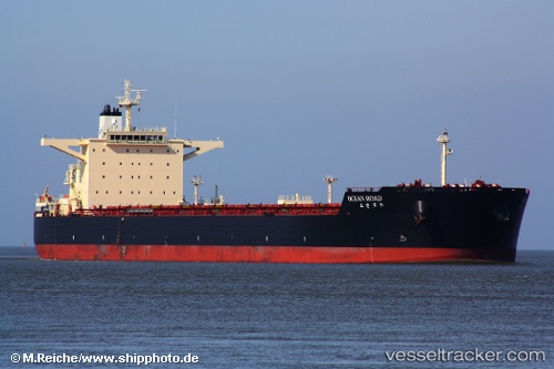
Ocean Road
Current StatusWhere is the vessel?
Ocean Road is currently in 14 nm W of Skardon River, based on AIS data received less than 1h ago.
Latest AIS update:
Current position: 11.75650° S, 141.78014° E (14 nm W of Skardon River)
Average speed (last 7 days): Loading…
Average speed (last 30 days): Loading…
Vessel profile: Ocean Road is a Bulk Carrier with dimensions 45m x 292m.
This page combines live AIS, route history, probable destination signals, nearby traffic, and port activity for practical vessel monitoring.
The current position of vessel Ocean Road is -11.75650 lat / 141.78014 lng. Updated: 2026-05-18 07:05:38 UTCNearest reference points:
- Near Torres Strait
- Near Thursday Island
Details:
Live Vessel Ocean Road Analytics (details, animations, etc.)
Recent AIS points (UTC):
2026-05-18 03:50:08 UTC · -11.75666, 141.78027 · SOG 0 kn · COG 203°2026-05-18 04:20:08 UTC · -11.75686, 141.78067 · SOG 0 kn · COG 209°
2026-05-18 05:41:08 UTC · -11.75693, 141.78107 · SOG 0 kn · COG 208°
2026-05-18 07:05:38 UTC · -11.75650, 141.78014 · SOG 0 kn · COG 185°