 vesseltracker.com
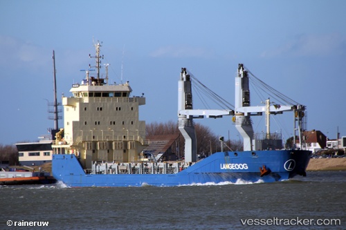
 Langeoog
Current Status
Where is the vessel?
Langeoog is currently in 33 nm N of Grote Berg, based on AIS data received less than 1h ago.
Latest AIS update:
Current position: 12.71885° N, 68.85918° W (33 nm N of Grote Berg)
Average speed (last 7 days): Loading…
Average speed (last 30 days): Loading…
Vessel profile: Langeoog is a Multi Purpose Carrier with dimensions 108m x 16m.
This page combines live AIS, route history, probable destination signals, nearby traffic, and port activity for practical vessel monitoring.
The current position of vessel Langeoog is 12.71885 lat / -68.85918 lng. Updated: 2026-05-16 22:06:49 UTCNearest reference points:
- Near Bullenbaai
- 24 nm NW of Palm Beach
- Near Las Piedras
Currently sailing under the flag of Antigua Barbuda ![]()
Details:
Live Vessel Langeoog Analytics (details, animations, etc.)
Recent AIS points (UTC):
2026-05-16 17:22:10 UTC · 12.79563, -69.39853 · SOG 6.8 kn · COG 100°2026-05-16 19:15:17 UTC · 12.76333, -69.17833 · SOG 7 kn · COG -1°
2026-05-16 21:53:27 UTC · 12.72256, -68.88454 · SOG 6.5 kn · COG 96°
2026-05-16 22:06:49 UTC · 12.71885, -68.85918 · SOG 6.8 kn · COG 98°