 vesseltracker.com
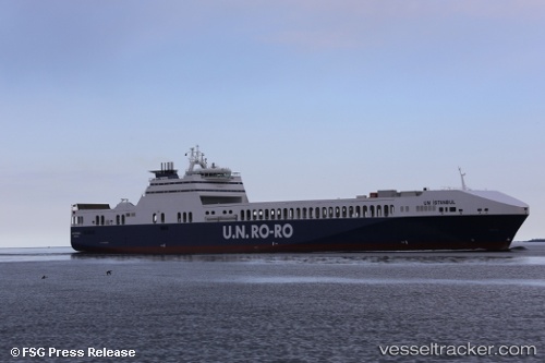
 Un Istanbul
Current Status
Where is the vessel?
Un Istanbul is currently in 30 nm W of Komiza, based on AIS data received less than 1h ago.
Latest AIS update:
Current position: 43.00869° N, 15.40633° E (30 nm W of Komiza)
Average speed (last 7 days): Loading…
Average speed (last 30 days): Loading…
Vessel profile: Un Istanbul is a Ro Ro Cargo Ship with dimensions 208m x 26m.
This page combines live AIS, route history, probable destination signals, nearby traffic, and port activity for practical vessel monitoring.
The current position of vessel Un Istanbul is 43.00869 lat / 15.40633 lng. Updated: 2026-05-17 21:42:05 UTCNearest reference points:
- 26 nm N of Isole Tremiti
- Near Primosten
- Near Podglavica
Currently sailing under the flag of Turkey ![]()
Un Istanbul built in 2013 year
Deadweight:
15000 tDetails:
Live Vessel Un Istanbul Analytics (details, animations, etc.)
Recent AIS points (UTC):
2026-05-17 18:07:26 UTC · 42.19302, 16.35898 · SOG 17.7 kn · COG 312°2026-05-17 19:33:28 UTC · 42.51228, 15.96793 · SOG 18.1 kn · COG 319°
2026-05-17 20:09:27 UTC · 42.65184, 15.81301 · SOG 18 kn · COG 319°
2026-05-17 21:42:05 UTC · 43.00869, 15.40633 · SOG 18.2 kn · COG 318°