 vesseltracker.com
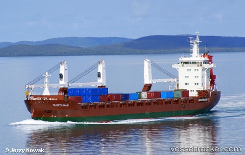
 FLORETGRACHT
Current Status
Where is the vessel?
FLORETGRACHT is currently in 23 nm N of Schönheide, based on AIS data received about 1h ago.
Latest AIS update:
Current position: 50.87833° N, 12.61333° W (23 nm N of Schönheide)
Average speed (last 7 days): Loading…
Average speed (last 30 days): Loading…
Vessel profile: FLORETGRACHT is a General Cargo Ship with dimensions m x m.
This page combines live AIS, route history, probable destination signals, nearby traffic, and port activity for practical vessel monitoring.
The current position of vessel FLORETGRACHT is 50.87833 lat / -12.61333 lng. Updated: 2026-05-17 14:00:19 UTCNearest reference points:
- 20 nm SE of Wunschendorf
Currently sailing under the flag of Netherlands ![]()
FLORETGRACHT built in 2012 year
Deadweight:
12067 tDetails:
Live Vessel FLORETGRACHT Analytics (details, animations, etc.)
Recent AIS points (UTC):
2026-05-17 10:27:19 UTC · 50.73167, -12.05166 · SOG 6 kn · COG -1°2026-05-17 11:48:22 UTC · 50.78500, -12.28167 · SOG 6 kn · COG -1°
2026-05-17 14:00:19 UTC · 50.87833, -12.61333 · SOG 4 kn · COG -1°
2026-05-17 14:00:19 UTC · 50.87833, -12.61333 · SOG 4 kn · COG -1°