 vesseltracker.com
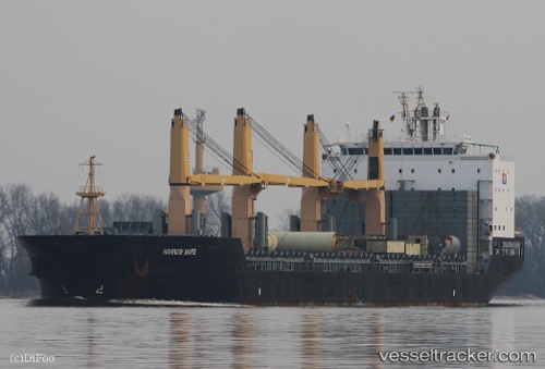
 LILAC ROLLER
Current Status
Where is the vessel?
LILAC ROLLER is currently in 99 nm S of Las Brujas, based on AIS data received about 2h ago.
Latest AIS update:
Current position: 22.06345° N, 18.92779° W (99 nm S of Las Brujas)
Average speed (last 7 days): Loading…
Average speed (last 30 days): Loading…
Vessel profile: LILAC ROLLER is a General Cargo with dimensions m x m.
This page combines live AIS, route history, probable destination signals, nearby traffic, and port activity for practical vessel monitoring.
The current position of vessel LILAC ROLLER is 22.06345 lat / -18.92779 lng. Updated: 2026-05-17 23:08:11 UTCNearest reference points:
- 41 nm NW of Nouadhibou
- Near Nouadhibou
- 68 nm NW of Ad Dakhla
Currently sailing under the flag of Marshall Islands ![]()
Details:
Live Vessel LILAC ROLLER Analytics (details, animations, etc.)
Recent AIS points (UTC):
2026-05-17 19:42:14 UTC · 22.70696, -18.49984 · SOG 13.2 kn · COG 210°2026-05-17 22:02:15 UTC · 22.27474, -18.79508 · SOG 13.2 kn · COG 207°
2026-05-17 22:21:43 UTC · 22.21257, -18.83483 · SOG 13.3 kn · COG 207°
2026-05-17 23:08:11 UTC · 22.06345, -18.92779 · SOG 13.2 kn · COG 207°