 vesseltracker.com
 LACERTA
Current Status
Where is the vessel?
LACERTA is currently in 26 nm SE of Arrecife De Lanzarote, based on AIS data received less than 1h ago.
Latest AIS update:
Current position: 28.63584° N, 13.19527° W (26 nm SE of Arrecife De Lanzarote)
Average speed (last 7 days): Loading…
Average speed (last 30 days): Loading…
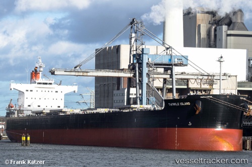
Vessel profile: LACERTA is a Bulk Carrier with dimensions m x m.
This page combines live AIS, route history, probable destination signals, nearby traffic, and port activity for practical vessel monitoring.
The current position of vessel LACERTA is 28.63584 lat / -13.19527 lng. Updated: 2026-05-18 04:12:11 UTCNearest reference points:
- Near Lanzarote
- Near LAS COLORADAS
- Near Aaiun
Currently sailing under the flag of Liberia ![]()
Details:
Live Vessel LACERTA Analytics (details, animations, etc.)
Recent AIS points (UTC):
2026-05-17 23:28:28 UTC · 27.97333, -13.74667 · SOG 10 kn · COG -1°2026-05-18 01:31:31 UTC · 28.27063, -13.50541 · SOG 10.4 kn · COG 34°
2026-05-18 01:36:12 UTC · 28.28196, -13.49687 · SOG 10.4 kn · COG 34°
2026-05-18 04:12:11 UTC · 28.63584, -13.19527 · SOG 9.3 kn · COG 34°