 vesseltracker.com
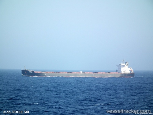
 Anglo Marimar
Current Status
Where is the vessel?
Anglo Marimar is currently in 115 nm W of LHOKNGA, based on AIS data received about 1h ago.
Latest AIS update:
Current position: 5.63070° N, 93.32708° E (115 nm W of LHOKNGA)
Average speed (last 7 days): Loading…
Average speed (last 30 days): Loading…
Vessel profile: Anglo Marimar is a Bulk Carrier with dimensions 240m x 240m.
This page combines live AIS, route history, probable destination signals, nearby traffic, and port activity for practical vessel monitoring.
The current position of vessel Anglo Marimar is 5.63070 lat / 93.32708 lng. Updated: 2026-05-17 19:59:12 UTCNearest reference points:
- 80 nm W of Sebang
- 160 nm W of Sebang
- 172 nm W of LHOKNGA
Currently sailing under the flag of United Kingdom ![]()
Anglo Marimar built in 2011 year
Deadweight:
98000 tDetails:
Live Vessel Anglo Marimar Analytics (details, animations, etc.)
Recent AIS points (UTC):
2026-05-17 19:16:01 UTC · 5.58826, 93.20419 · SOG 10.5 kn · COG 68°2026-05-17 19:16:01 UTC · 5.58826, 93.20419 · SOG 10.5 kn · COG 68°
2026-05-17 19:59:12 UTC · 5.63070, 93.32708 · SOG 10.9 kn · COG 69°
2026-05-17 19:59:12 UTC · 5.63070, 93.32708 · SOG 10.9 kn · COG 69°