 vesseltracker.com
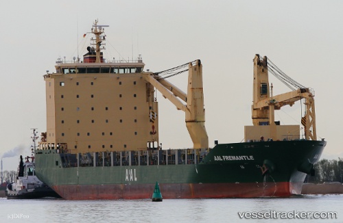
 AAL FREMANTLE
Current Status
Where is the vessel?
AAL FREMANTLE is currently in 94 nm NW of PARE PARE, based on AIS data received less than 1h ago.
Latest AIS update:
Current position: 2.86333° S, 118.54500° E (94 nm NW of PARE PARE)
Average speed (last 7 days): Loading…
Average speed (last 30 days): Loading…
Vessel profile: AAL FREMANTLE is a General Cargo Ship with dimensions 149m x 22m.
This page combines live AIS, route history, probable destination signals, nearby traffic, and port activity for practical vessel monitoring.
The current position of vessel AAL FREMANTLE is -2.86333 lat / 118.54500 lng. Updated: 2026-05-18 04:14:36 UTCNearest reference points:
- 57 nm NE of TANJUNG PEMANCINGAN
- 18 nm E of Senipah Oil Terminal
- Near Senipah Oil Terminal
Currently sailing under the flag of Cyprus ![]()
AAL FREMANTLE built in 2011 year
Deadweight:
18762 tDetails:
Live Vessel AAL FREMANTLE Analytics (details, animations, etc.)
Recent AIS points (UTC):
2026-05-18 01:35:37 UTC · -2.28333, 118.66500 · SOG 12 kn · COG -1°2026-05-18 01:44:35 UTC · -2.31500, 118.65833 · SOG 12 kn · COG -1°
2026-05-18 03:26:33 UTC · -2.68333, 118.57833 · SOG 13 kn · COG -1°
2026-05-18 04:14:36 UTC · -2.86333, 118.54500 · SOG 13 kn · COG -1°