 vesseltracker.com
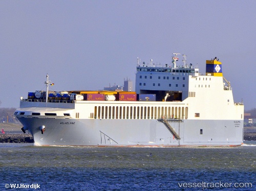
 Wilhelmine
Current Status
Where is the vessel?
Wilhelmine is currently in 13 nm NE of Broadstairs, based on AIS data received less than 1h ago.
Latest AIS update:
Current position: 51.51284° N, 1.68008° E (13 nm NE of Broadstairs)
Average speed (last 7 days): Loading…
Average speed (last 30 days): Loading…
Vessel profile: Wilhelmine is a Ro Ro Cargo Ship with dimensions 152m x 24m.
This page combines live AIS, route history, probable destination signals, nearby traffic, and port activity for practical vessel monitoring.
The current position of vessel Wilhelmine is 51.51284 lat / 1.68008 lng. Updated: 2026-05-13 01:17:30 UTCNearest reference points:
- Near Broadstairs
- 15 nm E of RAMSGATE
- 14 nm SE of RAMSGATE
Currently sailing under the flag of Malta ![]()
Wilhelmine built in 2012 year
Deadweight:
6374 tDetails:
Live Vessel Wilhelmine Analytics (details, animations, etc.)
Recent AIS points (UTC):
2026-05-12 21:52:21 UTC · 51.44781, 0.36276 · SOG 9.8 kn · COG 89°2026-05-12 22:27:32 UTC · 51.49971, 0.49719 · SOG 10.2 kn · COG 84°
2026-05-12 23:29:56 UTC · 51.47942, 0.93566 · SOG 16.9 kn · COG 90°
2026-05-13 01:17:30 UTC · 51.51284, 1.68008 · SOG 15.1 kn · COG 65°