 vesseltracker.com
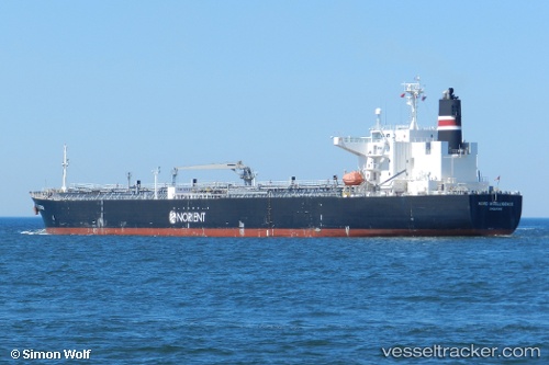
 EL BELLA
Current Status
Where is the vessel?
EL BELLA is currently in 75 nm SW of Abakaliki, based on AIS data received about 2h ago.
Latest AIS update:
Current position: 5.71528° N, 84.91515° E (75 nm SW of Abakaliki)
Average speed (last 7 days): Loading…
Average speed (last 30 days): Loading…
Vessel profile: EL BELLA is a Oil Products Tanker with dimensions m x m.
This page combines live AIS, route history, probable destination signals, nearby traffic, and port activity for practical vessel monitoring.
The current position of vessel EL BELLA is 5.71528 lat / 84.91515 lng. Updated: 2026-05-17 01:23:34 UTCNearest reference points:
- 46 nm SW of Abakaliki
- 127 nm W of Abakaliki
- 23 nm S of Abakaliki
Currently sailing under the flag of Panama ![]()
Details:
Live Vessel EL BELLA Analytics (details, animations, etc.)
Recent AIS points (UTC):
2026-05-17 00:02:03 UTC · 5.71738, 84.65770 · SOG 11.3 kn · COG 95°2026-05-17 01:23:34 UTC · 5.71528, 84.91515 · SOG 11.2 kn · COG 95°
2026-05-17 01:23:34 UTC · 5.71528, 84.91515 · SOG 11.2 kn · COG 95°
2026-05-17 01:23:34 UTC · 5.71528, 84.91515 · SOG 11.2 kn · COG 95°