 vesseltracker.com
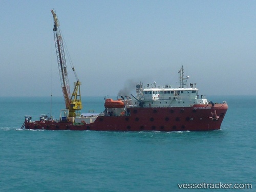
 GO ENDEAVOUR
Current Status
Where is the vessel?
GO ENDEAVOUR is currently in 12 nm NE of AL JUBAIL, based on AIS data received about 1h ago.
Latest AIS update:
Current position: 27.23167° N, 49.87167° E (12 nm NE of AL JUBAIL)
Average speed (last 7 days): Loading…
Average speed (last 30 days): Loading…
Vessel profile: GO ENDEAVOUR is a Work Vessel with dimensions m x m.
This page combines live AIS, route history, probable destination signals, nearby traffic, and port activity for practical vessel monitoring.
The current position of vessel GO ENDEAVOUR is 27.23167 lat / 49.87167 lng. Updated: 2026-05-17 22:25:11 UTCNearest reference points:
- 13 nm NE of AL JUBAIL
- Near Al Jubayl
- Near Al Jubayl Industrial City
Currently sailing under the flag of Marshall Islands ![]()
Details:
Live Vessel GO ENDEAVOUR Analytics (details, animations, etc.)
Recent AIS points (UTC):
2026-05-17 19:22:58 UTC · 27.23309, 49.87284 · SOG 0.1 kn · COG 322°2026-05-17 19:53:01 UTC · 27.23315, 49.87293 · SOG 0.1 kn · COG 336°
2026-05-17 22:14:23 UTC · 27.23313, 49.87295 · SOG 0.2 kn · COG 339°
2026-05-17 22:25:11 UTC · 27.23167, 49.87167 · SOG 0 kn · COG -1°