 vesseltracker.com
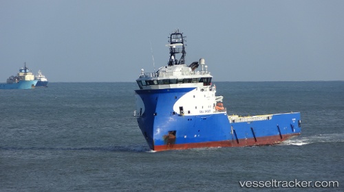
 SERVICE TIDE
Current Status
Where is the vessel?
SERVICE TIDE is currently in 36 nm SW of Kvitebjorn, based on AIS data received less than 1h ago.
Latest AIS update:
Current position: 60.82316° N, 1.39541° E (36 nm SW of Kvitebjorn)
Average speed (last 7 days): Loading…
Average speed (last 30 days): Loading…
Vessel profile: SERVICE TIDE is a Offshore Supply Ship with dimensions m x m.
This page combines live AIS, route history, probable destination signals, nearby traffic, and port activity for practical vessel monitoring.
The current position of vessel SERVICE TIDE is 60.82316 lat / 1.39541 lng. Updated: 2026-05-18 05:33:53 UTCNearest reference points:
- 10 nm N of Leadon
Currently sailing under the flag of United Kingdom ![]()
Details:
Live Vessel SERVICE TIDE Analytics (details, animations, etc.)
Recent AIS points (UTC):
2026-05-18 02:15:54 UTC · 60.82332, 1.40036 · SOG 0.2 kn · COG 169°2026-05-18 03:41:54 UTC · 60.82447, 1.40213 · SOG 0.1 kn · COG 158°
2026-05-18 04:47:53 UTC · 60.82399, 1.39969 · SOG 0 kn · COG 156°
2026-05-18 05:33:53 UTC · 60.82316, 1.39541 · SOG 0.2 kn · COG 158°