 vesseltracker.com
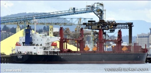
 ADASTAR
Current Status
Where is the vessel?
ADASTAR is currently in Near Cadiz, based on AIS data received less than 1h ago.
Latest AIS update:
Current position: 36.52160° N, 6.25661° W (Near Cadiz)
Average speed (last 7 days): Loading…
Average speed (last 30 days): Loading…
Vessel profile: ADASTAR is a Cargo with dimensions m x m.
This page combines live AIS, route history, probable destination signals, nearby traffic, and port activity for practical vessel monitoring.
The current position of vessel ADASTAR is 36.52160 lat / -6.25661 lng. Updated: 2026-05-17 23:28:21 UTCNearest reference points:
- Near Cadiz
- Near El Puerto de Santa María
- Near Conil de la Frontera
Currently sailing under the flag of Liberia ![]()
Details:
Live Vessel ADASTAR Analytics (details, animations, etc.)
Recent AIS points (UTC):
2026-05-17 19:49:30 UTC · 36.52164, -6.25659 · SOG 0 kn · COG 162°2026-05-17 22:01:29 UTC · 36.52166, -6.25665 · SOG 0 kn · COG 162°
2026-05-17 22:16:29 UTC · 36.52160, -6.25664 · SOG 0 kn · COG 162°
2026-05-17 23:28:21 UTC · 36.52160, -6.25661 · SOG 0 kn · COG 162°