 vesseltracker.com
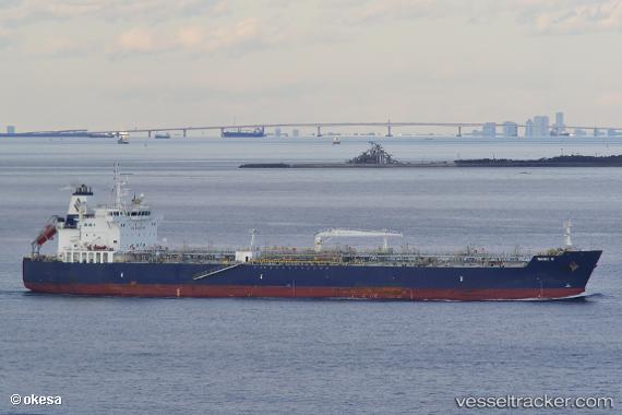
 TORM DIANA
Current Status
Where is the vessel?
TORM DIANA is currently in 17 nm E of Punta Mala, based on AIS data received about 1h ago.
Latest AIS update:
Current position: 7.48833° N, 79.71333° W (17 nm E of Punta Mala)
Average speed (last 7 days): Loading…
Average speed (last 30 days): Loading…
Vessel profile: TORM DIANA is a Tanker with dimensions m x m.
This page combines live AIS, route history, probable destination signals, nearby traffic, and port activity for practical vessel monitoring.
The current position of vessel TORM DIANA is 7.48833 lat / -79.71333 lng. Updated: 2026-05-17 07:41:40 UTCNearest reference points:
- 30 nm E of El Cirial (Isla Iguana)
- Near Saboga
- Near Melones
Currently sailing under the flag of Singapore ![]()
Details:
Live Vessel TORM DIANA Analytics (details, animations, etc.)
Recent AIS points (UTC):
2026-05-17 05:16:07 UTC · 7.95646, -79.44865 · SOG 13.4 kn · COG 177°2026-05-17 05:41:07 UTC · 7.86123, -79.44839 · SOG 13.7 kn · COG 178°
2026-05-17 07:34:04 UTC · 7.51018, -79.69220 · SOG 14.7 kn · COG 226°
2026-05-17 07:41:40 UTC · 7.48833, -79.71333 · SOG 15 kn · COG -1°