 vesseltracker.com
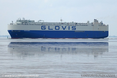
 GLOVIS SUMMIT
Current Status
Where is the vessel?
GLOVIS SUMMIT is currently in 87 nm NE of Nedroma, based on AIS data received about 1h ago.
Latest AIS update:
Current position: 35.66032° N, 13.09258° W (87 nm NE of Nedroma)
Average speed (last 7 days): Loading…
Average speed (last 30 days): Loading…
Vessel profile: GLOVIS SUMMIT is a Vehicles Carrier with dimensions m x m.
This page combines live AIS, route history, probable destination signals, nearby traffic, and port activity for practical vessel monitoring.
The current position of vessel GLOVIS SUMMIT is 35.66032 lat / -13.09258 lng. Updated: 2026-05-17 19:42:14 UTCNearest reference points:
- 110 nm E of Nedroma
- 75 nm NE of Nedroma
- 115 nm E of Nedroma
Currently sailing under the flag of South Korea ![]()
Details:
Live Vessel GLOVIS SUMMIT Analytics (details, animations, etc.)
Recent AIS points (UTC):
2026-05-17 16:16:59 UTC · 36.67827, -12.71319 · SOG 18.7 kn · COG 197°2026-05-17 17:39:24 UTC · 36.26651, -12.85831 · SOG 18.7 kn · COG 199°
2026-05-17 19:29:37 UTC · 35.72211, -13.06855 · SOG 18.5 kn · COG 199°
2026-05-17 19:42:14 UTC · 35.66032, -13.09258 · SOG 18.5 kn · COG 199°