 vesseltracker.com
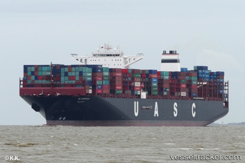
 AL NASRIYAH
Current Status
Where is the vessel?
AL NASRIYAH is currently in 68 nm SW of Kao-Hsiung Kang, based on AIS data received about 22h ago.
Latest AIS update:
Current position: 22.04119° N, 119.20499° E (68 nm SW of Kao-Hsiung Kang)
Average speed (last 7 days): Loading…
Average speed (last 30 days): Loading…
Vessel profile: AL NASRIYAH is a Cargo A with dimensions m x m.
This page combines live AIS, route history, probable destination signals, nearby traffic, and port activity for practical vessel monitoring.
The current position of vessel AL NASRIYAH is 22.04119 lat / 119.20499 lng. Updated: 2026-05-17 11:12:46 UTCNearest reference points:
- 96 nm SW of Kaohsiung
- 22 nm SW of Kaohsiung
- Near Tso-Ying
Currently sailing under the flag of Germany ![]()
Details:
Live Vessel AL NASRIYAH Analytics (details, animations, etc.)
Recent AIS points (UTC):
2026-05-17 11:12:46 UTC · 22.04119, 119.20499 · SOG 17.8 kn · COG 206°2026-05-17 11:12:46 UTC · 22.04119, 119.20499 · SOG 17.8 kn · COG 206°
2026-05-17 11:12:46 UTC · 22.04119, 119.20499 · SOG 17.8 kn · COG 206°
2026-05-17 11:12:46 UTC · 22.04119, 119.20499 · SOG 17.8 kn · COG 206°