 vesseltracker.com
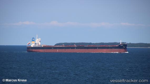
 Ronadi
Current Status
Where is the vessel?
Ronadi is currently in 186 nm NW of Mutineer, based on AIS data received about 2h ago.
Latest AIS update:
Current position: 16.84925° S, 114.56626° E (186 nm NW of Mutineer)
Average speed (last 7 days): Loading…
Average speed (last 30 days): Loading…
Vessel profile: Ronadi is a Bulk Carrier with dimensions 229m x 32m.
This page combines live AIS, route history, probable destination signals, nearby traffic, and port activity for practical vessel monitoring.
The current position of vessel Ronadi is -16.84925 lat / 114.56626 lng. Updated: 2026-05-18 04:03:49 UTCCurrently sailing under the flag of Liberia ![]()
Details:
Live Vessel Ronadi Analytics (details, animations, etc.)
Recent AIS points (UTC):
2026-05-18 01:35:09 UTC · -16.41317, 114.62190 · SOG 10.7 kn · COG 187°2026-05-18 01:44:11 UTC · -16.43943, 114.61901 · SOG 10.2 kn · COG 187°
2026-05-18 03:29:01 UTC · -16.74775, 114.58062 · SOG 10.8 kn · COG 188°
2026-05-18 04:03:49 UTC · -16.84925, 114.56626 · SOG 10.7 kn · COG 188°