 vesseltracker.com
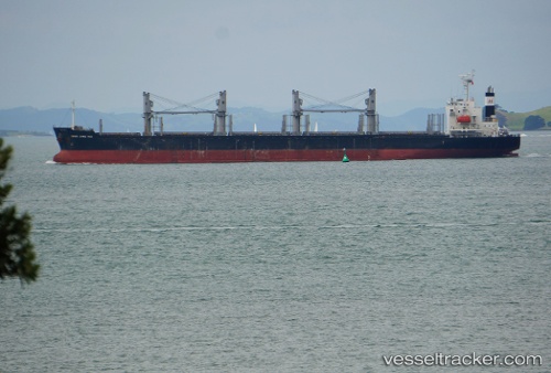
 AMIDALA
Current Status
Where is the vessel?
AMIDALA is currently in 194 nm E of Port Irene, based on AIS data received about 4h ago.
Latest AIS update:
Current position: 18.93711° N, 125.45615° E (194 nm E of Port Irene)
Average speed (last 7 days): Loading…
Average speed (last 30 days): Loading…
Vessel profile: AMIDALA is a Bulk Carrier with dimensions 30m x 180m.
This page combines live AIS, route history, probable destination signals, nearby traffic, and port activity for practical vessel monitoring.
The current position of vessel AMIDALA is 18.93711 lat / 125.45615 lng. Updated: 2026-05-17 17:10:18 UTCNearest reference points:
- 88 nm E of Port Irene
Currently sailing under the flag of Liberia ![]()
AMIDALA built in 2015 year
Deadweight:
34443 tDetails:
Live Vessel AMIDALA Analytics (details, animations, etc.)
Recent AIS points (UTC):
2026-05-15 22:25:40 UTC · 26.98513, 123.71688 · SOG 10 kn · COG 159°2026-05-17 17:10:18 UTC · 18.93711, 125.45615 · SOG 11 kn · COG 165°
2026-05-17 17:10:18 UTC · 18.93711, 125.45615 · SOG 11 kn · COG 165°
2026-05-17 17:10:18 UTC · 18.93711, 125.45615 · SOG 11 kn · COG 165°