 vesseltracker.com
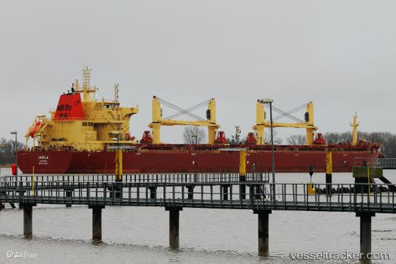
 SHEILA
Current Status
Where is the vessel?
SHEILA is currently in 44 nm S of Usulután, based on AIS data received less than 1h ago.
Latest AIS update:
Current position: 12.59745° N, 88.41178° W (44 nm S of Usulután)
Average speed (last 7 days): Loading…
Average speed (last 30 days): Loading…
Vessel profile: SHEILA is a Bulk Carrier with dimensions 32m x 190m.
This page combines live AIS, route history, probable destination signals, nearby traffic, and port activity for practical vessel monitoring.
The current position of vessel SHEILA is 12.59745 lat / -88.41178 lng. Updated: 2026-05-18 05:48:34 UTCNearest reference points:
- Near El Salvador
- Near San Jose
- 27 nm W of Playa Conchal
Currently sailing under the flag of Marshall Islands ![]()
SHEILA built in 2016 year
Deadweight:
58608 tDetails:
Live Vessel SHEILA Analytics (details, animations, etc.)
Recent AIS points (UTC):
2026-05-18 02:07:19 UTC · 12.81232, -89.12965 · SOG 12 kn · COG 108°2026-05-18 04:21:48 UTC · 12.68328, -88.69029 · SOG 12.2 kn · COG 109°
2026-05-18 04:41:43 UTC · 12.66432, -88.62606 · SOG 11.9 kn · COG 110°
2026-05-18 05:48:34 UTC · 12.59745, -88.41178 · SOG 12 kn · COG 108°