 vesseltracker.com
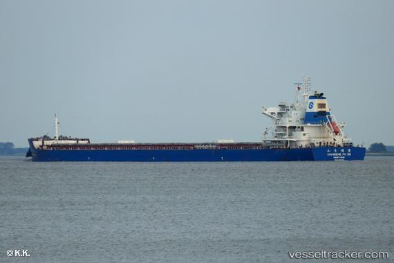
 SEA NOVA
Current Status
Where is the vessel?
SEA NOVA is currently in 187 nm SE of Dam Mon, based on AIS data received about 1h ago.
Latest AIS update:
Current position: 11.41167° N, 112.32333° E (187 nm SE of Dam Mon)
Average speed (last 7 days): Loading…
Average speed (last 30 days): Loading…
Vessel profile: SEA NOVA is a Cargo with dimensions m x m.
This page combines live AIS, route history, probable destination signals, nearby traffic, and port activity for practical vessel monitoring.
The current position of vessel SEA NOVA is 11.41167 lat / 112.32333 lng. Updated: 2026-05-17 16:17:31 UTCNearest reference points:
- 163 nm E of Vinh Cam Ranh
- 211 nm N of Pulau Lang Lang
- 226 nm SE of Tan Cang Qui Nhon
Currently sailing under the flag of Liberia ![]()
Details:
Live Vessel SEA NOVA Analytics (details, animations, etc.)
Recent AIS points (UTC):
2026-05-17 13:26:31 UTC · 11.78500, 112.62500 · SOG 9 kn · COG -1°2026-05-17 14:20:31 UTC · 11.66833, 112.53167 · SOG 10 kn · COG -1°
2026-05-17 15:59:33 UTC · 11.45167, 112.35500 · SOG 10 kn · COG -1°
2026-05-17 16:17:31 UTC · 11.41167, 112.32333 · SOG 10 kn · COG -1°