 vesseltracker.com
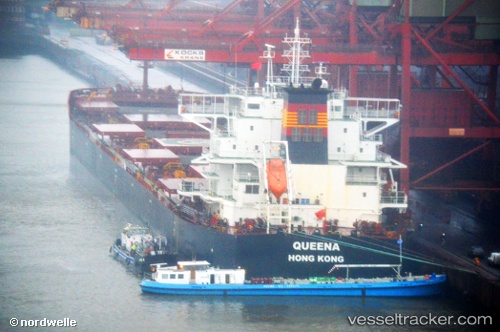
 QUEENA
Current Status
Where is the vessel?
QUEENA is currently in Near Tatoosh Island, based on AIS data received less than 1h ago.
Latest AIS update:
Current position: 48.48347° N, 124.62794° W (Near Tatoosh Island)
Average speed (last 7 days): Loading…
Average speed (last 30 days): Loading…
Vessel profile: QUEENA is a Cargo with dimensions m x m.
This page combines live AIS, route history, probable destination signals, nearby traffic, and port activity for practical vessel monitoring.
The current position of vessel QUEENA is 48.48347 lat / -124.62794 lng. Updated: 2026-05-18 01:22:22 UTCNearest reference points:
- Near Clallam Bay
- 21 nm NW of Tatoosh Island
- Near Cassidy
Currently sailing under the flag of Marshall Islands ![]()
Details:
Live Vessel QUEENA Analytics (details, animations, etc.)
Recent AIS points (UTC):
2026-05-17 22:30:23 UTC · 48.30917, -123.97177 · SOG 9.9 kn · COG 291°2026-05-17 23:27:24 UTC · 48.35886, -124.18689 · SOG 9.5 kn · COG 295°
2026-05-18 01:14:10 UTC · 48.47500, -124.60167 · SOG 8 kn · COG -1°
2026-05-18 01:22:22 UTC · 48.48347, -124.62794 · SOG 8.4 kn · COG 290°