 vesseltracker.com
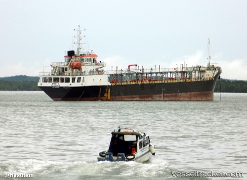
 SS NAVIGATOR
Current Status
Where is the vessel?
SS NAVIGATOR is currently in 67 nm NW of Okha, based on AIS data received about 14h ago.
Latest AIS update:
Current position: 22.93539° N, 67.98301° E (67 nm NW of Okha)
Average speed (last 7 days): Loading…
Average speed (last 30 days): Loading…
Vessel profile: SS NAVIGATOR is a Tanker with dimensions m x m.
This page combines live AIS, route history, probable destination signals, nearby traffic, and port activity for practical vessel monitoring.
The current position of vessel SS NAVIGATOR is 22.93539 lat / 67.98301 lng. Updated: 2026-05-17 19:21:18 UTCNearest reference points:
- 13 nm W of Måndvi
- Near Khambhaliya
- 49 nm S of Positra
Currently sailing under the flag of Tuvalu ![]()
Details:
Live Vessel SS NAVIGATOR Analytics (details, animations, etc.)
Recent AIS points (UTC):
2026-05-17 15:22:47 UTC · 22.92065, 67.52064 · SOG 6.5 kn · COG -1°2026-05-17 17:08:19 UTC · 22.93119, 67.72705 · SOG 6.7 kn · COG -1°
2026-05-17 18:10:55 UTC · 22.93438, 67.85033 · SOG 6.4 kn · COG -1°
2026-05-17 19:21:18 UTC · 22.93539, 67.98301 · SOG 6 kn · COG -1°