 vesseltracker.com
Live AIS position:
31.24480° N, 29.68850° E UTC. Near EL DEKHEILA),
updated 2025-11-20 04:08:46 UTC.
Find the position of the vessel Gabriel A on the map. The latter are known coordinates and path.
marine traffic ship tracker show on live map
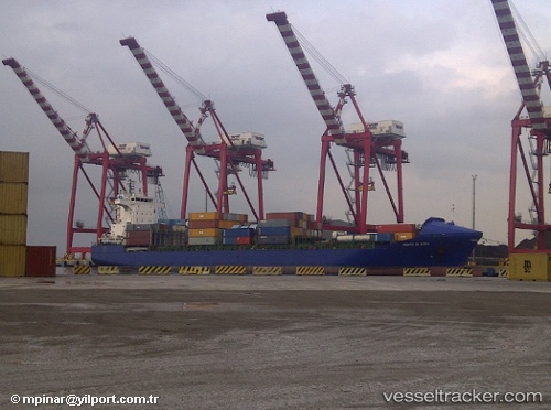
The current position of vessel Gabriel A is 31.2448 lat / 29.6885 lng. Updated: 2025-11-20 04:08:46 UTCCurrently sailing under the flag of Malta
Gabriel A built in 2004 year
Deadweight:
17264 tDetails:
Last coordinates of the vessel:
UTC, 31.2451, 29.688, course: 52, speed: 0UTC, 31.2449, 29.6884, course: 36, speed: 0
UTC, 31.2448, 29.6885, course: 31, speed: 0
2025-11-20 04:08:46 UTC, 31.2448, 29.6885, course: 33, speed: 0