 vesseltracker.com
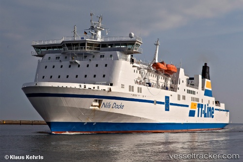
 Robin Hood
Current Status
Where is the vessel?
Robin Hood is currently in 10 nm NW of Rerik, based on AIS data received less than 1h ago.
Latest AIS update:
Current position: 54.20910° N, 11.38790° E (10 nm NW of Rerik)
Average speed (last 7 days): Loading…
Average speed (last 30 days): Loading…
Vessel profile: Robin Hood is a Passenger Ro Ro Cargo Ship with dimensions 179m x 28m.
This page combines live AIS, route history, probable destination signals, nearby traffic, and port activity for practical vessel monitoring.
The current position of vessel Robin Hood is 54.2091 lat / 11.3879 lng. Updated: 2026-05-18 04:49:12 UTCNearest reference points:
- Near BURGSTAAKEN
- Near Wismar
- Near Grossenbrode
Currently sailing under the flag of Germany ![]()
Robin Hood built in 1995 year
Deadweight:
6538 tDetails:
Live Vessel Robin Hood Analytics (details, animations, etc.)
Recent AIS points (UTC):
2026-05-18 01:47:53 UTC · 54.77250, 12.41560 · SOG 15.6 kn · COG 213°2026-05-18 02:13:11 UTC · 54.67870, 12.31400 · SOG 15.9 kn · COG 209°
2026-05-18 03:42:54 UTC · 54.39410, 11.88340 · SOG 18.1 kn · COG 237°
2026-05-18 04:49:12 UTC · 54.20910, 11.38790 · SOG 18.9 kn · COG 238°