 vesseltracker.com
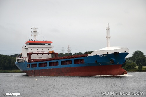
Vessel Ostra IMO: 9045742, MMSI: 215231000 General Cargo Ship
UTC, 31.2509, 32.304, course: 204, speed: 0.1
UTC, 31.2509, 32.3039, course: 204, speed: 0
2026-01-17 00:24:39 UTC, 31.2509, 32.304, course: 204, speed: 0
Live AIS position:
UTC. Near Port Said West),
updated 2026-01-17 00:24:39 UTC.
Find the position of the vessel Ostra on the map. The latter are known coordinates and path.
marine traffic ship tracker show on live map
The current position of vessel Ostra is 31.2509 lat / 32.304 lng. Updated: 2026-01-17 00:24:39 UTCDetails:
Last coordinates of the vessel:
UTC, 31.2929, 32.3412, course: 219, speed: 11.4UTC, 31.2509, 32.304, course: 204, speed: 0.1
UTC, 31.2509, 32.3039, course: 204, speed: 0
2026-01-17 00:24:39 UTC, 31.2509, 32.304, course: 204, speed: 0