 vesseltracker.com
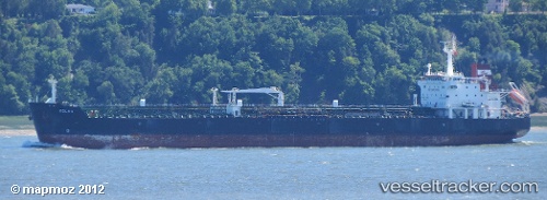
 CH ELIXIR
Current Status
Where is the vessel?
CH ELIXIR is currently in Near Paraguana Refinery Center, based on AIS data received less than 1h ago.
Latest AIS update:
Current position: 11.62081° N, 70.23326° W (Near Paraguana Refinery Center)
Average speed (last 7 days): Loading…
Average speed (last 30 days): Loading…
Vessel profile: CH ELIXIR is a Oil/Chemical Tanker with dimensions m x m.
This page combines live AIS, route history, probable destination signals, nearby traffic, and port activity for practical vessel monitoring.
The current position of vessel CH ELIXIR is 11.62081 lat / -70.23326 lng. Updated: 2026-05-18 05:59:26 UTCNearest reference points:
- Near Las Piedras
- Near Bullenbaai
- 24 nm NW of Palm Beach
Currently sailing under the flag of Barbados ![]()
Details:
Live Vessel CH ELIXIR Analytics (details, animations, etc.)
Recent AIS points (UTC):
2026-05-18 02:20:26 UTC · 11.62081, -70.23326 · SOG 0 kn · COG 62°2026-05-18 04:20:26 UTC · 11.62080, -70.23326 · SOG 0 kn · COG 63°
2026-05-18 04:41:26 UTC · 11.62084, -70.23328 · SOG 0.1 kn · COG 62°
2026-05-18 05:59:26 UTC · 11.62081, -70.23326 · SOG 0 kn · COG 62°