 vesseltracker.com
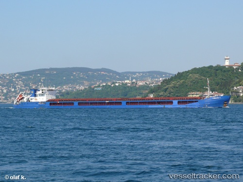
Vessel Chelsea 2 IMO: 9314442, MMSI: 256365000 Multi Purpose Carrier
UTC, 42.13734, 28.36596, course: 3, speed: 5.2
UTC, 42.23500, 28.35500, course: -1, speed: 5
2026-01-16 13:37:42 UTC, 42.25833, 28.35167, course: -1, speed: 5
Live AIS position:
UTC. 20 nm NE of Akhtopol),
updated 2026-01-16 13:37:42 UTC.
Find the position of the vessel Chelsea 2 on the map. The latter are known coordinates and path.
marine traffic ship tracker show on live map
The current position of vessel Chelsea 2 is 42.25833 lat / 28.35167 lng. Updated: 2026-01-16 13:37:42 UTCCurrently sailing under the flag of Malta
Chelsea 2 built in 2005 year
Deadweight:
6081 tDetails:
Last coordinates of the vessel:
UTC, 41.95021, 28.37378, course: 3, speed: 6.2UTC, 42.13734, 28.36596, course: 3, speed: 5.2
UTC, 42.23500, 28.35500, course: -1, speed: 5
2026-01-16 13:37:42 UTC, 42.25833, 28.35167, course: -1, speed: 5