 vesseltracker.com
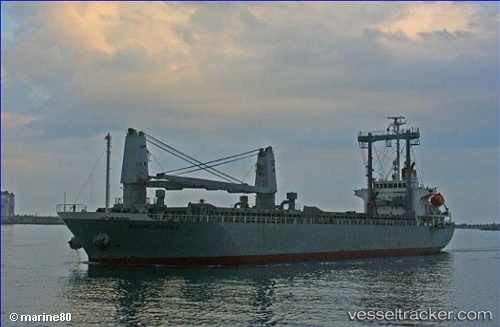
Vessel ADNAN N IMO: 9334973, MMSI: 314580000 General Cargo Ship
UTC, 38.59170, -11.81237, course: 195, speed: 10.3
UTC, 38.45744, -11.85145, course: 195, speed: 10.8
2026-01-18 20:27:42 UTC, 38.19964, -11.92730, course: 197, speed: 10.7
Live AIS position:
UTC. 76 nm W of Los Ramos),
updated 2026-01-18 20:27:42 UTC.
Find the position of the vessel ADNAN N on the map. The latter are known coordinates and path.
marine traffic ship tracker show on live map
The current position of vessel ADNAN N is 38.19964 lat / -11.92730 lng. Updated: 2026-01-18 20:27:42 UTCCurrently sailing under the flag of Barbados
ADNAN N built in 2006 year
Deadweight:
11776 tDetails:
Last coordinates of the vessel:
UTC, 38.59170, -11.81237, course: 195, speed: 10.3UTC, 38.59170, -11.81237, course: 195, speed: 10.3
UTC, 38.45744, -11.85145, course: 195, speed: 10.8
2026-01-18 20:27:42 UTC, 38.19964, -11.92730, course: 197, speed: 10.7