 vesseltracker.com
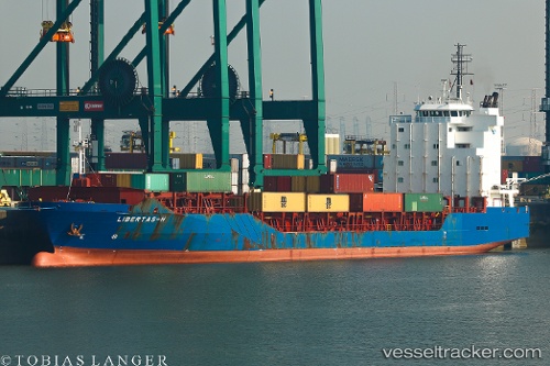
Vessel Libertas h IMO: 9388388, MMSI: 255805480 Multi Purpose Carrier
UTC, 43.40542, 4.94492, course: 75, speed: 0
UTC, 43.40504, 4.94518, course: 53, speed: 0
2026-01-19 23:55:09 UTC, 43.40489, 4.94535, course: 48, speed: 0
Live AIS position:
UTC. Near Port-de-Bouc),
updated 2026-01-19 23:55:09 UTC.
Find the position of the vessel Libertas h on the map. The latter are known coordinates and path.
marine traffic ship tracker show on live map
The current position of vessel Libertas h is 43.40489 lat / 4.94535 lng. Updated: 2026-01-19 23:55:09 UTCCurrently sailing under the flag of Portugal
Libertas h built in 2007 year
Deadweight:
8716 tDetails:
Last coordinates of the vessel:
UTC, 43.40465, 4.94589, course: 25, speed: 0.1UTC, 43.40542, 4.94492, course: 75, speed: 0
UTC, 43.40504, 4.94518, course: 53, speed: 0
2026-01-19 23:55:09 UTC, 43.40489, 4.94535, course: 48, speed: 0