 vesseltracker.com
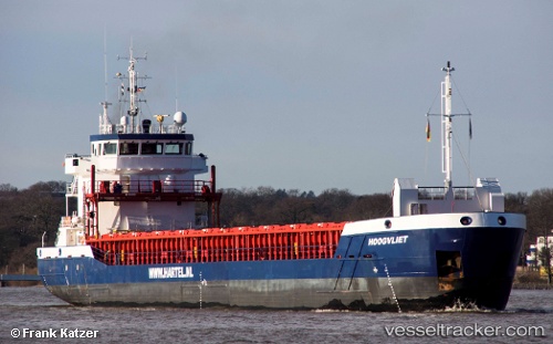
Vessel Hoogvliet IMO: 9625231, MMSI: 246458000 General Cargo Ship
UTC, 53.18895, 5.42943, course: 284, speed: 0
UTC, 53.18894, 5.42942, course: 284, speed: 0
2026-01-17 06:19:04 UTC, 53.18894, 5.42942, course: 284, speed: 0
Live AIS position:
UTC. Near HARLINGEN),
updated 2026-01-17 06:19:04 UTC.
Find the position of the vessel Hoogvliet on the map. The latter are known coordinates and path.
marine traffic ship tracker show on live map
The current position of vessel Hoogvliet is 53.18894 lat / 5.42942 lng. Updated: 2026-01-17 06:19:04 UTCCurrently sailing under the flag of Netherlands
Hoogvliet built in 2013 year
Deadweight:
3729 tDetails:
Last coordinates of the vessel:
UTC, 53.18896, 5.42942, course: 284, speed: 0UTC, 53.18895, 5.42943, course: 284, speed: 0
UTC, 53.18894, 5.42942, course: 284, speed: 0
2026-01-17 06:19:04 UTC, 53.18894, 5.42942, course: 284, speed: 0