 vesseltracker.com
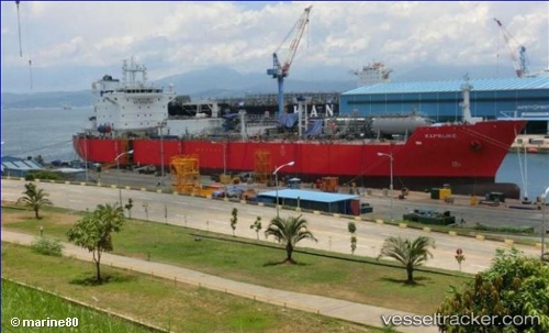
Kaprijke
Current StatusWhere is the vessel?
Kaprijke is currently in 13 nm SE of Port Bolivar, based on AIS data received about 1h ago.
Latest AIS update:
Current position: 29.27401° N, 94.51861° W (13 nm SE of Port Bolivar)
Average speed (last 7 days): Loading…
Average speed (last 30 days): Loading…
Vessel profile: Kaprijke is a Lpg Tanker with dimensions 30m x 180m.
This page combines live AIS, route history, probable destination signals, nearby traffic, and port activity for practical vessel monitoring.
The current position of vessel Kaprijke is 29.27401 lat / -94.51861 lng. Updated: 2026-05-18 05:36:54 UTCNearest reference points:
- 12 nm SE of Port Bolivar
- Near Port Bolivar
- Near Texas City
Details:
Live Vessel Kaprijke Analytics (details, animations, etc.)
Recent AIS points (UTC):
2026-05-18 01:46:46 UTC · 28.99723, -94.64648 · SOG 11.7 kn · COG 59°2026-05-18 04:08:58 UTC · 29.26751, -94.51643 · SOG 3.9 kn · COG 13°
2026-05-18 04:51:55 UTC · 29.27388, -94.51881 · SOG 0.1 kn · COG 118°
2026-05-18 05:36:54 UTC · 29.27401, -94.51861 · SOG 0.1 kn · COG 122°