 vesseltracker.com
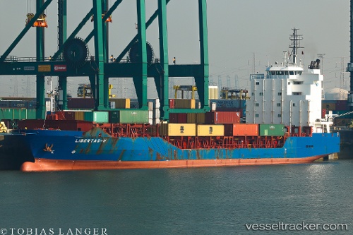
Vessel Libertas h IMO: 9388388, MMSI: 255805480 Multi Purpose Carrier
UTC, 36.76658, 3.06166, course: 286, speed: 0
UTC, 36.76658, 3.06166, course: 286, speed: 0
2026-02-10 11:52:32 UTC, 36.76659, 3.06166, course: 286, speed: 0
Live AIS position:
UTC. Near ALGER),
updated 2026-02-10 11:52:32 UTC.
Find the position of the vessel Libertas h on the map. The latter are known coordinates and path.
marine traffic ship tracker show on live map
The current position of vessel Libertas h is 36.76659 lat / 3.06166 lng. Updated: 2026-02-10 11:52:32 UTCCurrently sailing under the flag of Portugal
Libertas h built in 2007 year
Deadweight:
8716 tDetails:
Last coordinates of the vessel:
UTC, 36.76658, 3.06166, course: 286, speed: 0UTC, 36.76658, 3.06166, course: 286, speed: 0
UTC, 36.76658, 3.06166, course: 286, speed: 0
2026-02-10 11:52:32 UTC, 36.76659, 3.06166, course: 286, speed: 0