 vesseltracker.com
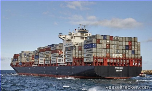
 Wieland
Current Status
Where is the vessel?
Wieland is currently in 76 nm E of Bombinhas, based on AIS data received about 1h ago.
Latest AIS update:
Current position: 26.72600° S, 47.18667° W (76 nm E of Bombinhas)
Average speed (last 7 days): Loading…
Average speed (last 30 days): Loading…
Vessel profile: Wieland is a Container Ship with dimensions 255m x 37m.
This page combines live AIS, route history, probable destination signals, nearby traffic, and port activity for practical vessel monitoring.
The current position of vessel Wieland is -26.72600 lat / -47.18667 lng. Updated: 2026-05-18 01:53:48 UTCNearest reference points:
- 113 nm E of Balneário Barra do Sul
- 32 nm E of Caioba
- 10 nm NE of CAMBORIU
Currently sailing under the flag of Portugal ![]()
Details:
Live Vessel Wieland Analytics (details, animations, etc.)
Recent AIS points (UTC):
2026-05-17 22:06:52 UTC · -25.91533, -46.93100 · SOG 13.2 kn · COG 196°2026-05-18 00:14:29 UTC · -26.37167, -47.07450 · SOG 13.7 kn · COG 196°
2026-05-18 01:00:47 UTC · -26.53933, -47.12717 · SOG 13.4 kn · COG 196°
2026-05-18 01:53:48 UTC · -26.72600, -47.18667 · SOG 13.1 kn · COG 194°