 vesseltracker.com
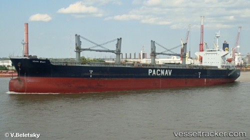
 MERAKLIS
Current Status
Where is the vessel?
MERAKLIS is currently in 101 nm SW of Cap Skiring, based on AIS data received about 1h ago.
Latest AIS update:
Current position: 11.62731° N, 18.29152° W (101 nm SW of Cap Skiring)
Average speed (last 7 days): Loading…
Average speed (last 30 days): Loading…
Vessel profile: MERAKLIS is a Bulk Carrier with dimensions 32m x 190m.
This page combines live AIS, route history, probable destination signals, nearby traffic, and port activity for practical vessel monitoring.
The current position of vessel MERAKLIS is 11.62731 lat / -18.29152 lng. Updated: 2026-05-17 16:10:20 UTCNearest reference points:
- 48 nm W of Cap Skiring
- 144 nm SW of Bubaque
- Near San Francisco Libre
Currently sailing under the flag of Bahamas ![]()
MERAKLIS built in 2001 year
Deadweight:
50296 tDetails:
Live Vessel MERAKLIS Analytics (details, animations, etc.)
Recent AIS points (UTC):
2026-05-17 14:00:20 UTC · 12.01848, -18.27305 · SOG 10.8 kn · COG 185°2026-05-17 14:04:25 UTC · 12.00606, -18.27351 · SOG 10.9 kn · COG 185°
2026-05-17 16:07:06 UTC · 11.63695, -18.29185 · SOG 10.5 kn · COG 179°
2026-05-17 16:10:20 UTC · 11.62731, -18.29152 · SOG 10.6 kn · COG 179°