 vesseltracker.com
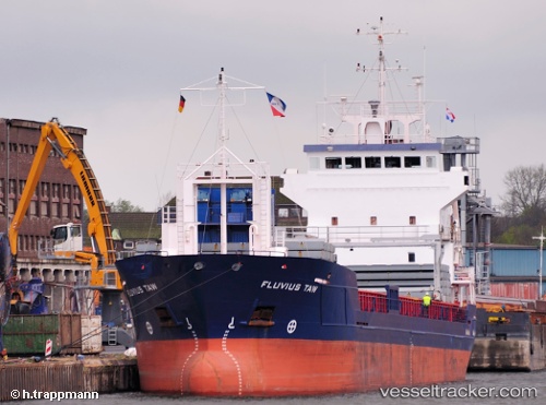
Vessel Fluvius Taw IMO: 9195858, MMSI: 314431000 Multi Purpose Carrier
UTC, 38.30333, 14.31167, course: -1, speed: 11
UTC, 38.30167, 14.88167, course: -1, speed: 10
2026-02-28 02:07:56 UTC, 38.34758, 15.44467, course: 82, speed: 11.1
Live AIS position:
UTC. Near Rometta Marea),
updated 2026-02-28 02:07:56 UTC.
Find the position of the vessel Fluvius Taw on the map. The latter are known coordinates and path.
marine traffic ship tracker show on live map
The current position of vessel Fluvius Taw is 38.34758 lat / 15.44467 lng. Updated: 2026-02-28 02:07:56 UTCCurrently sailing under the flag of Barbados
Fluvius Taw built in 2000 year
Deadweight:
5050 tDetails:
Last coordinates of the vessel:
UTC, 38.30667, 14.04167, course: -1, speed: 12UTC, 38.30333, 14.31167, course: -1, speed: 11
UTC, 38.30167, 14.88167, course: -1, speed: 10
2026-02-28 02:07:56 UTC, 38.34758, 15.44467, course: 82, speed: 11.1