 vesseltracker.com
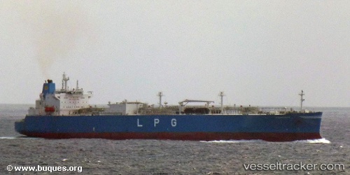
 TETHYS
Current Status
Where is the vessel?
TETHYS is currently in 184 nm NW of Luderitz Bay, based on AIS data received about 1h ago.
Latest AIS update:
Current position: 25.16806° S, 12.16381° E (184 nm NW of Luderitz Bay)
Average speed (last 7 days): Loading…
Average speed (last 30 days): Loading…
Vessel profile: TETHYS is a Tanker with dimensions m x m.
This page combines live AIS, route history, probable destination signals, nearby traffic, and port activity for practical vessel monitoring.
The current position of vessel TETHYS is -25.16806 lat / 12.16381 lng. Updated: 2026-05-18 05:35:25 UTCNearest reference points:
- 161 nm W of Walvisbaai
- 151 nm W of Henties Bay (Hentiesbaai)
- Near WALVIS BAY
Currently sailing under the flag of Panama ![]()
Details:
Live Vessel TETHYS Analytics (details, animations, etc.)
Recent AIS points (UTC):
2026-05-18 02:08:57 UTC · -24.42497, 11.88680 · SOG 13.3 kn · COG 160°2026-05-18 03:42:35 UTC · -24.76079, 12.01414 · SOG 13.3 kn · COG 162°
2026-05-18 04:48:22 UTC · -24.99712, 12.10022 · SOG 13.6 kn · COG 160°
2026-05-18 05:35:25 UTC · -25.16806, 12.16381 · SOG 13.7 kn · COG 160°