 vesseltracker.com
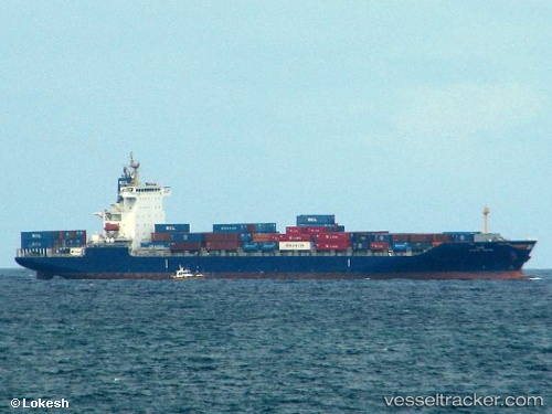
 HMM MANILA
Current Status
Where is the vessel?
HMM MANILA is currently in 22 nm SW of Alaminos, based on AIS data received about 18h ago.
Latest AIS update:
Current position: 15.95780° N, 119.63538° E (22 nm SW of Alaminos)
Average speed (last 7 days): Loading…
Average speed (last 30 days): Loading…
Vessel profile: HMM MANILA is a Container Ship with dimensions m x m.
This page combines live AIS, route history, probable destination signals, nearby traffic, and port activity for practical vessel monitoring.
The current position of vessel HMM MANILA is 15.95780 lat / 119.63538 lng. Updated: 2026-05-16 21:54:16 UTCNearest reference points:
- 34 nm W of Iba
- 19 nm SW of MARIVELES
- Near Malabon
Currently sailing under the flag of South Korea ![]()
Details:
Live Vessel HMM MANILA Analytics (details, animations, etc.)
Recent AIS points (UTC):
2026-05-16 21:54:16 UTC · 15.95780, 119.63538 · SOG 15.8 kn · COG 355°2026-05-16 21:54:16 UTC · 15.95780, 119.63538 · SOG 15.8 kn · COG 355°
2026-05-16 21:54:16 UTC · 15.95780, 119.63538 · SOG 15.8 kn · COG 355°
2026-05-16 21:54:16 UTC · 15.95780, 119.63538 · SOG 15.8 kn · COG 355°