 vesseltracker.com
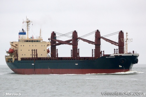
 LIBRA
LIBRA
Current Status
Where is the vessel?
LIBRA is currently in 90 nm SW of Gialtra, based on AIS data received less than 1h ago.
Latest AIS update:
Current position: 22.10785° N, 37.47402° E (90 nm SW of Gialtra)
Average speed (last 7 days): Loading…
Average speed (last 30 days): Loading…
Vessel profile: LIBRA is a Bulk Carrier with dimensions m x m.
This page combines live AIS, route history, probable destination signals, nearby traffic, and port activity for practical vessel monitoring.
The current position of vessel LIBRA is 22.10785 lat / 37.47402 lng. Updated: 2026-05-18 07:14:18 UTCNearest reference points:
- 65 nm SW of King Abdullah City
- 67 nm W of Tusdeer Free Zone
- 95 nm SW of Al Muajjiz
Currently sailing under the flag of Palau ![]()
Details:
Live Vessel LIBRA Analytics (details, animations, etc.)
Recent AIS points (UTC):
2026-05-18 03:55:48 UTC · 21.54693, 37.79817 · SOG 11.9 kn · COG 334°2026-05-18 04:13:58 UTC · 21.59980, 37.76830 · SOG 11.9 kn · COG 332°
2026-05-18 05:54:39 UTC · 21.89543, 37.59945 · SOG 11.9 kn · COG 335°
2026-05-18 07:14:18 UTC · 22.10785, 37.47402 · SOG 10.5 kn · COG 328°