 vesseltracker.com
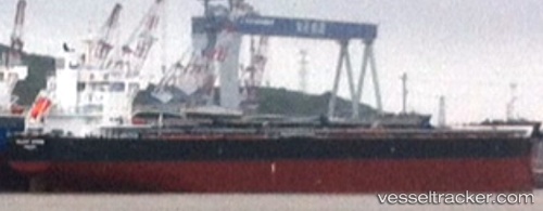
 VELA
VELA
Current Status
Where is the vessel?
VELA is currently in Near Paranagua, based on AIS data received about 1h ago.
Latest AIS update:
Current position: 25.49979° S, 48.54465° W (Near Paranagua)
Average speed (last 7 days): Loading…
Average speed (last 30 days): Loading…
Vessel profile: VELA is a Cargo with dimensions m x m.
This page combines live AIS, route history, probable destination signals, nearby traffic, and port activity for practical vessel monitoring.
The current position of vessel VELA is -25.49979 lat / -48.54465 lng. Updated: 2026-05-17 01:39:21 UTCNearest reference points:
- 24 nm E of Caioba
- 32 nm E of Caioba
- Near Itajai
Currently sailing under the flag of Marshall Islands ![]()
Details:
Live Vessel VELA Analytics (details, animations, etc.)
Recent AIS points (UTC):
2026-05-16 23:04:26 UTC · -25.49833, -48.54333 · SOG 0 kn · COG -1°2026-05-16 23:58:26 UTC · -25.49833, -48.54333 · SOG 0 kn · COG -1°
2026-05-17 01:39:21 UTC · -25.49979, -48.54465 · SOG 0 kn · COG 263°
2026-05-17 01:39:21 UTC · -25.49979, -48.54465 · SOG 0 kn · COG 263°