 vesseltracker.com
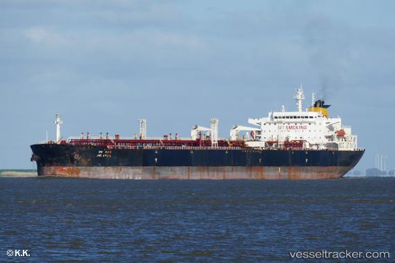
 INA
INA
Current Status
Where is the vessel?
INA is currently in 16 nm SW of Villafranca Tirrena, based on AIS data received less than 1h ago.
Latest AIS update:
Current position: 36.03386° N, 15.22331° E (16 nm SW of Villafranca Tirrena)
Average speed (last 7 days): Loading…
Average speed (last 30 days): Loading…
Vessel profile: INA is a Crude Oil Tanker with dimensions m x m.
This page combines live AIS, route history, probable destination signals, nearby traffic, and port activity for practical vessel monitoring.
The current position of vessel INA is 36.03386 lat / 15.22331 lng. Updated: 2026-05-18 07:50:17 UTCNearest reference points:
- 18 nm E of Il-Kappara
- 13 nm E of Il-Kappara
- Near Xghajra
Currently sailing under the flag of Cameroon ![]()
Details:
Live Vessel INA Analytics (details, animations, etc.)
Recent AIS points (UTC):
2026-05-18 04:46:56 UTC · 36.22702, 14.48513 · SOG 12 kn · COG 112°2026-05-18 05:34:48 UTC · 36.16763, 14.67026 · SOG 12.2 kn · COG 111°
2026-05-18 07:41:28 UTC · 36.03990, 15.18643 · SOG 12.4 kn · COG 102°
2026-05-18 07:50:17 UTC · 36.03386, 15.22331 · SOG 12.4 kn · COG 102°